
PRISTINE PACIFIC BAY · ENSENADA DEL NARANJO · FACING COIBA NATIONAL PARK
5.89 ha · ≈ 483 m of sandy beach with coconut palms · sheltered bay · year-round freshwater stream · tropical forest · Offshore fishing · Coiba · surf · nature · adventure · glamping · ≈ 2 h from Panama City: charter flight to Hicaco + 45 min by boat
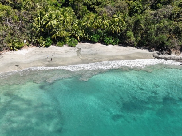
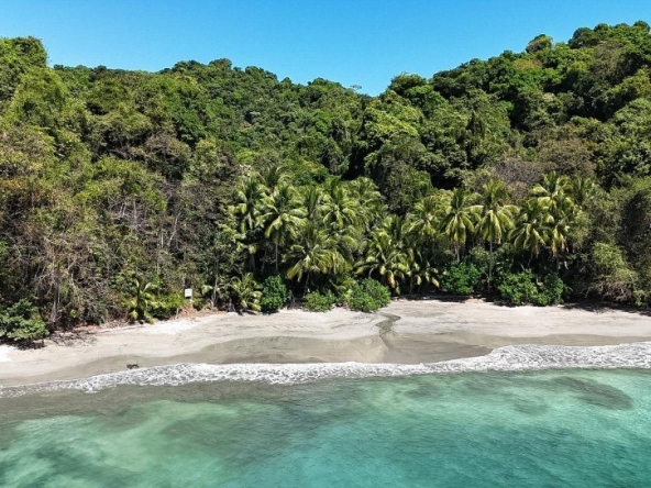
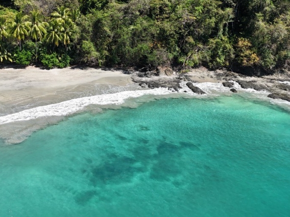
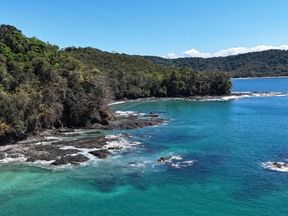
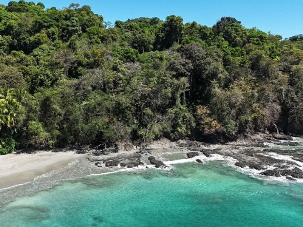
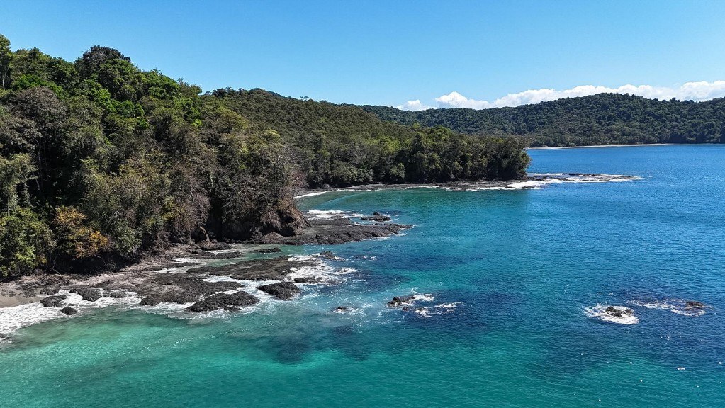
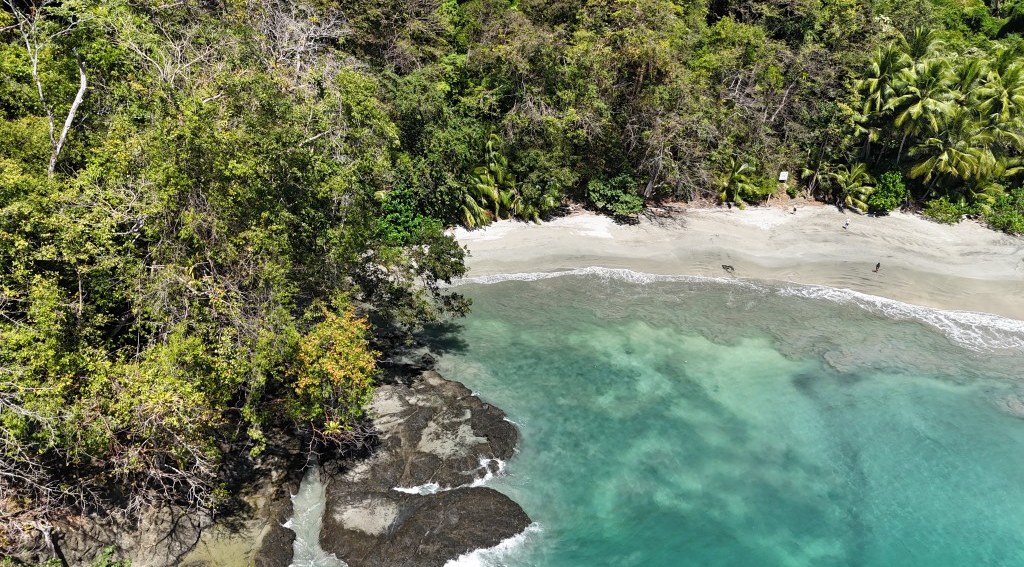
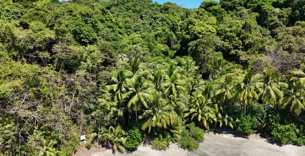
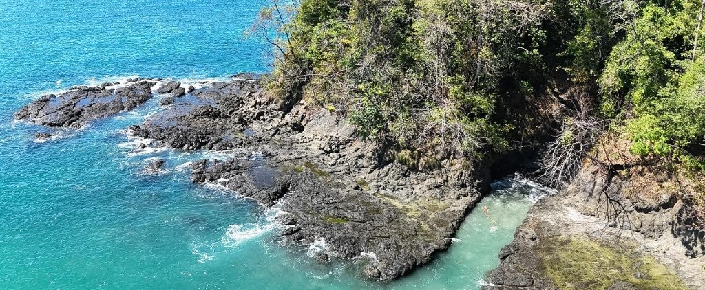
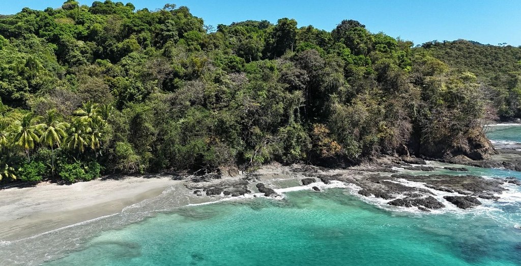
A 58,928.21 m² (5 ha + 8,928.21 m²) parcel on the Ensenada del Naranjo, one of the most beautiful and sheltered bays of Isla Cebaco, with direct frontage on the Pacific Ocean: a sandy beach lined with coconut palms, volcanic-rock points with natural pools, a year-round freshwater stream running through the land and hillsides of tropical forest. One hour by boat from Coiba National Park and Santa Catalina: a unique base for offshore fishing, diving, surf, nature and glamping.
| Area | 58,928.21 m² = 5 ha + 8,928.21 m² (≈ 5.89 ha ≈ 14.56 acres). Perimeter 1,330.72 m; ≈ 379 m (N–S) × 362 m (E–W). |
| Location | Ensenada del Naranjo, south coast of Isla Cebaco. Cebaco (corregimiento), Montijo District, Veraguas Province, Panama. Centre of the polygon: 7.4975° N, 81.2327° W. |
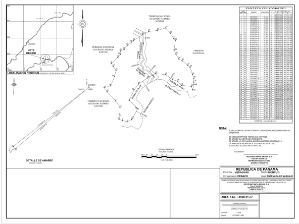
| Legal status | Land titling in progress. Parcel of land for tourism use under purchase application to the State before the National Land Administration Authority (ANATI) in favour of Sociedad Mata Bruja, S.A. (Folio No. 665598 (S)). Survey plan of October 2026 (1:2,000), 52 monumented survey points. |
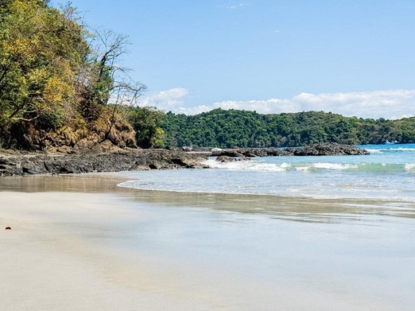
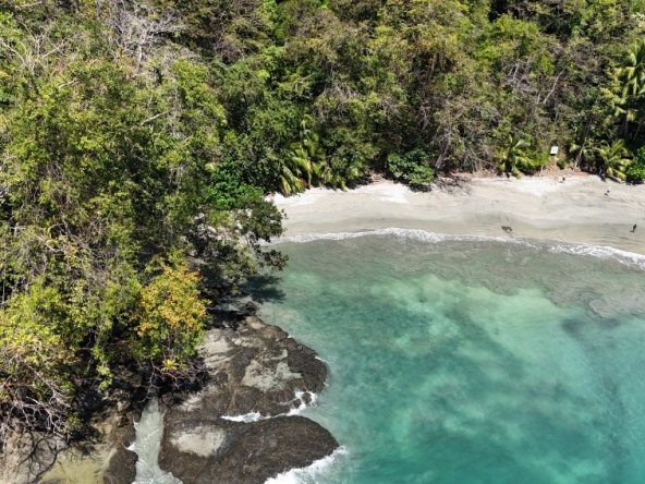
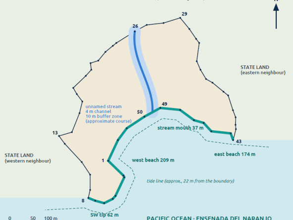
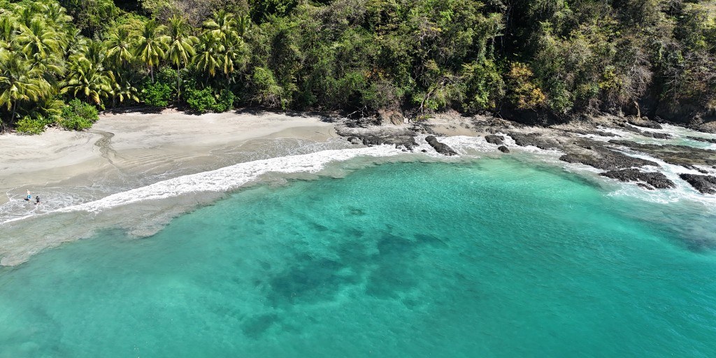
| Beach frontage | ≈ 483 linear metres of coastal frontage on the Pacific Ocean beach strip (survey points 43 to 8): two stretches of sandy beach separated by the mouth of the stream and framed by volcanic-rock points. South-southeast orientation. |
| Access | By air + boat, ≈ 2 h from Panama City: charter or empty-leg flight (≈ 45 min – 1 h) to the private Lago Bay airstrip (MPLY) at Hicaco (Santa Catalina); 5 min away, boarding at Hicaco and 45 min by boat (≈ 20 miles) watching whales, dolphins, turtles and tuna. Rental villas next to the airstrip. By road and sea: Puerto Mutis, Playa Reina or Playa Malena. Landing directly on the beach, inside the sheltered bay. |
| Connectivity | Starlink satellite internet with battery and solar panel, already in use on the island. |
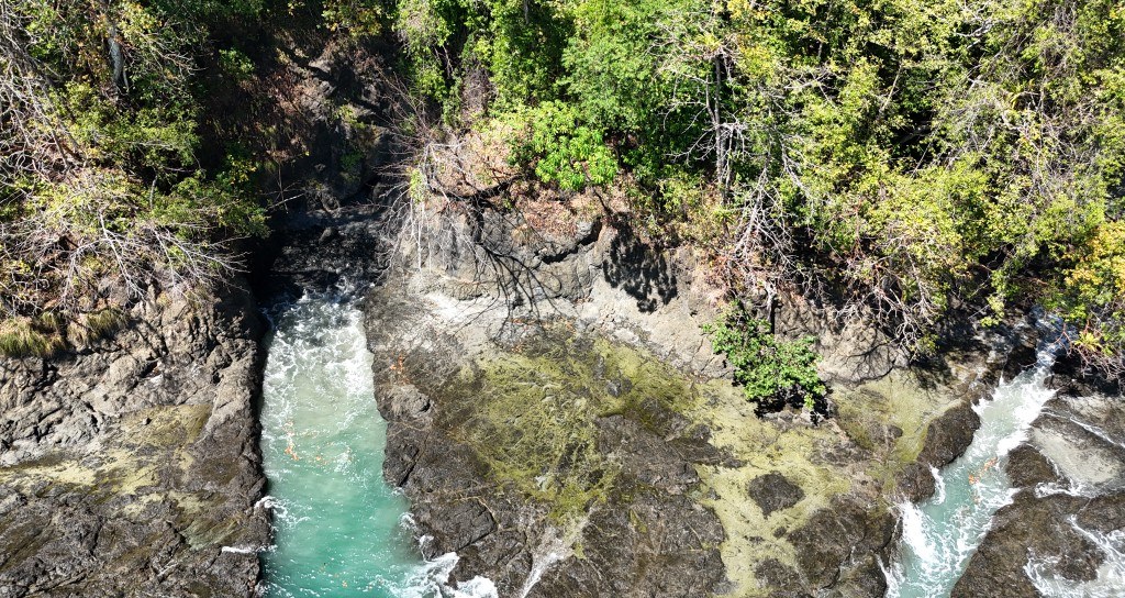
| Freshwater stream | Stream ≈ 4 m wide crossing the land from north to south (≈ 170 m) and flowing out onto the beach; visible flow at the height of the dry season (January 2026). 10 m buffer zone on each bank. |
| The sea | Offshore and inshore fishing (Gulf of Montijo, Coiba, Hannibal Bank, Gulf of ChiriquÃ); world-class diving in Coiba National Park (World Heritage Site); humpback whales from July to November; snorkelling off the property’s own beach. |
| Potential | Offshore-fishing lodge and nautical base · beach glamping and eco-resort · surf, diving and adventure (Coiba, Santa Catalina) · private retreat in nature. |
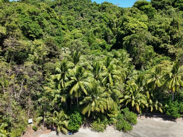
| Current condition | Untouched land, no buildings or infrastructure. Flat coastal strip with beach and palm grove; hillsides of dense tropical forest. Fresh water from the stream. |
| Price | To be agreed — to be indicated by the owner. |
58,928 m²
Area (5.89 ha)
483 m
Coastal frontage
≈ 170 m
Stream inside the lot
52
Monumented survey points
Isla Cebaco
Isla Cebaco is the third-largest island of Panama (≈ 80 km²; about 25 km long and 2 to 5 km wide). It lies at the mouth of the Gulf of Montijo, on the Pacific side of Veraguas Province, some 15 km west of the Azuero Peninsula and east of Isla Coiba (Coiba National Park, World Heritage Site). Isla Gobernadora is ≈ 3 km to the north-west. Its highest point is Cerro Chichica (349 m). The island keeps a small local community devoted mainly to fishing and offers palm-fringed sandy beaches, cliffs, forests and numerous freshwater streams and springs.
Marine environment
The bay benefits from the mangroves of the Gulf of Montijo, a natural nursery for snook, snapper, grouper and corvina; offshore, yellowfin tuna, roosterfish, sailfish and dorado abound. Humpback whales from July to November; crystal-clear water for snorkelling and diving, with Coiba, Hannibal Bank and the Gulf of Chiriquí reachable by sea.
Getting there
| From | Route |
| Panama City · by air | Charter or empty-leg flight from Albrook (PAC) or Tocumen (PTY) to the private Lago Bay airstrip (MPLY) at Hicaco (Santa Catalina): ≈ 45 min – 1 h. Five minutes from the airstrip, boarding the boat at Hicaco. |
| Hicaco · by boat | 45 min · ≈ 20 miles to the property, watching whales, dolphins, turtles and tuna along the way. |
| Puerto Mutis (Montijo) | 30–40 km by sea. 25 min from Santiago de Veraguas and ≈ 4 h from Panama City by road. |
| Playa Reina · Malena · Torio | Boat departures from the Mariato coast. |
| Landing | Directly on the property’s beach, inside the sheltered bay (natural anchorage). |
≈ 2 hours from Panama City to the beach · tourist logistics already in place
charter / empty-leg flight to Lago Bay (MPLY) + 5 min to Hicaco + 45 min by boat rental villas next to the airstrip, used by the owners: tourist trips can already be organised
Reference coordinates
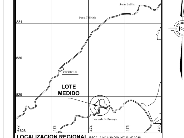
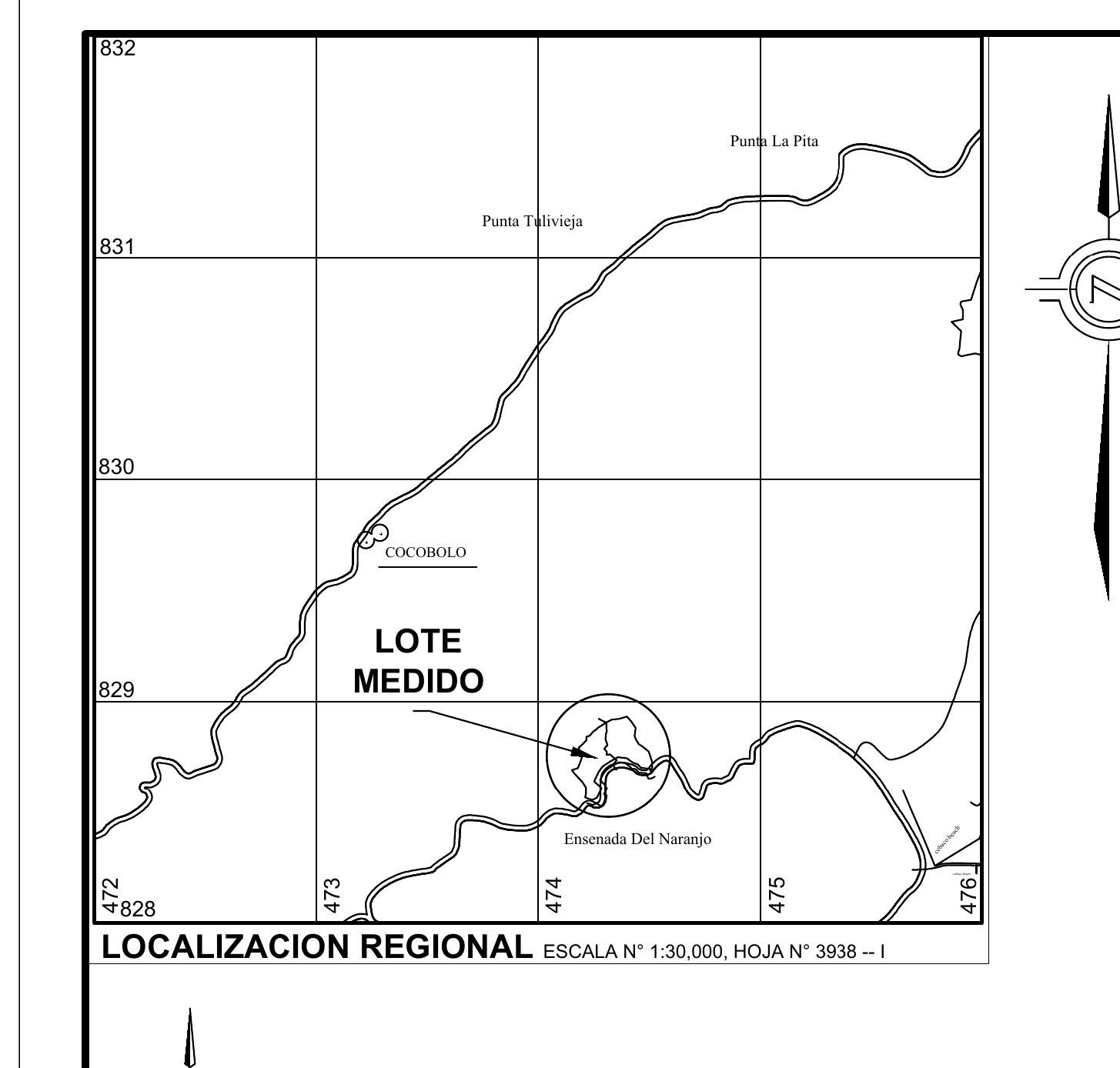
Centre of the polygon: 7.4975° N, 81.2327° W (WGS-84) · UTM 17N: N 828,748 / E 474,328. Geodetic tie-in point of the survey: El Jobo school, ≈ 5.6 km to the north-east.
References on the plan
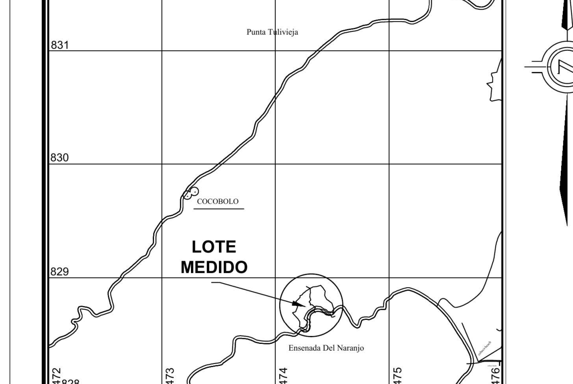
Cocobolo ≈ 1.4 km NW · Punta Tulivieja ≈ 2.6 km N · Punta La Pita ≈ 3.4 km NE · El Jobo school ≈ 5.6 km NE (tie-in point).
Area
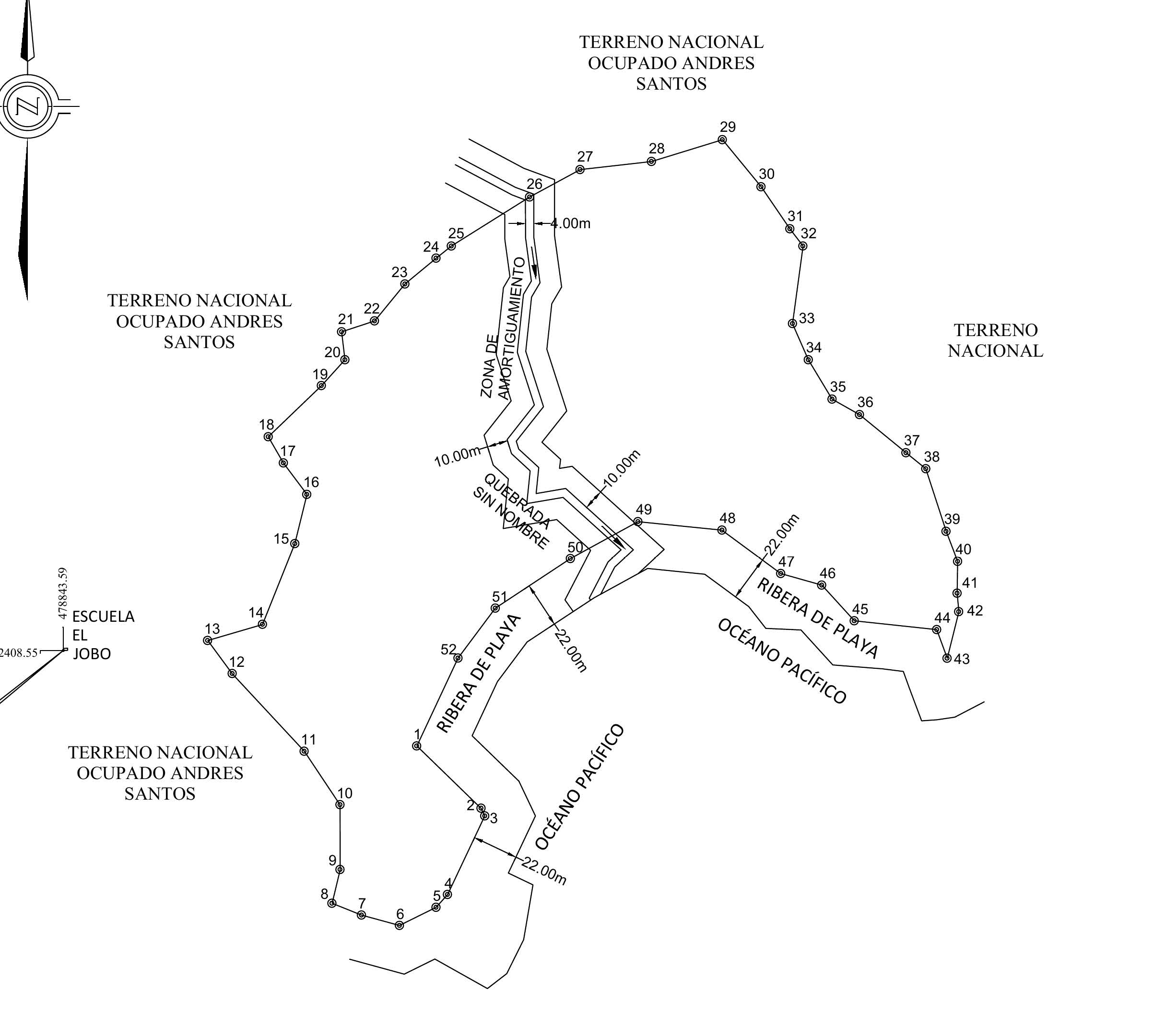
58,928.21 m² ≈ 5 ha + 8,928.21 m² (≈ 5.89 ha / 14.56 acres). Total perimeter 1,330.72 m. Maximum extent ≈ 379 m (N-S) x 362 m (E-W).
Boundaries and measurements
| Boundary | Adjoining | Points | Length |
| South (point) | Caribbean Sea — marine concession | 15 to 1 | 272.4 m |
| North-east | State land occupied by Wyne Yeurx Peman | 11 to 15 | 269.2 m |
| West | State land occupied by Mariano | 1 to 11 | 271.0 m |
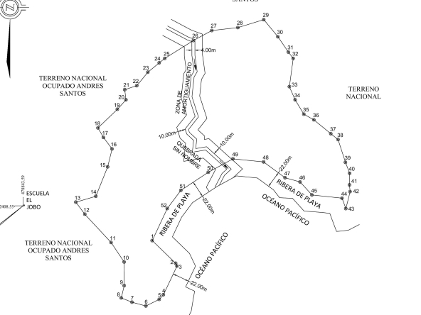
Features shown on the plan
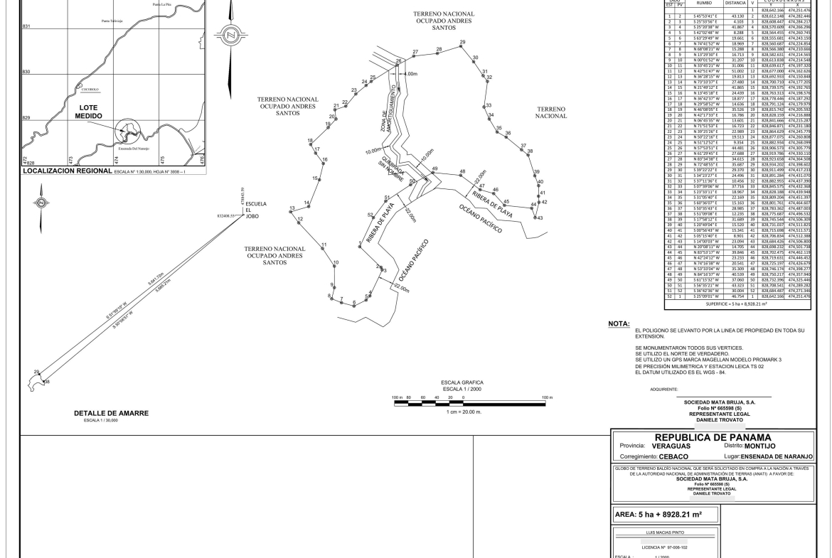
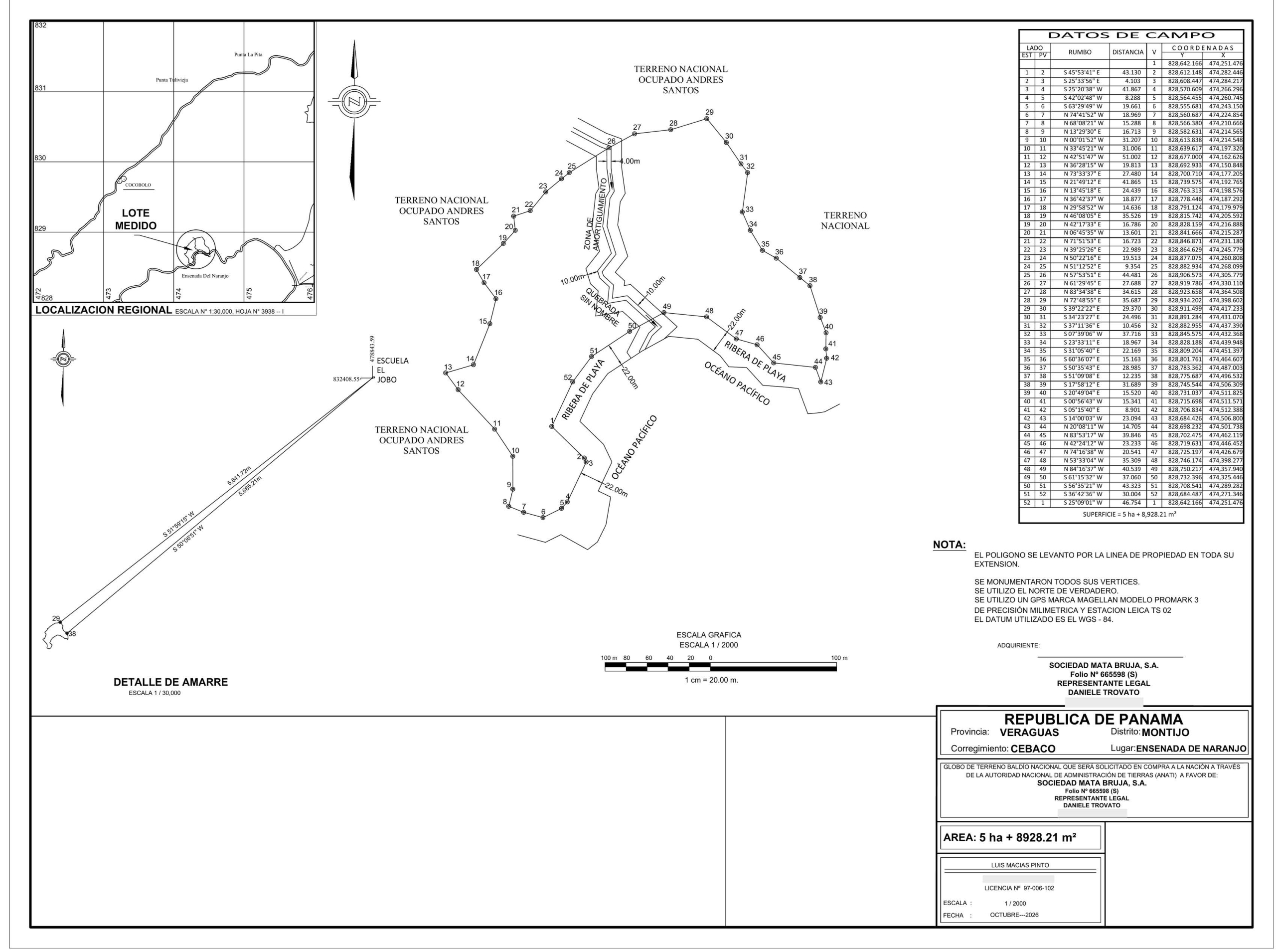
Topographic survey
| Surveyor | Luis Macías Pinto — Licence No. 97-006-102 |
| Date / scale | October 2026 · 1:2,000 · map sheet No. 3938-I |
| Equipment | Magellan ProMark 3 GPS (millimetre precision) and Leica TS02 total station |
| Datum / north | WGS-84 · true north · polygon surveyed along the property line over its entire length |
Beach frontage measurements
| Stretch | Points | Length |
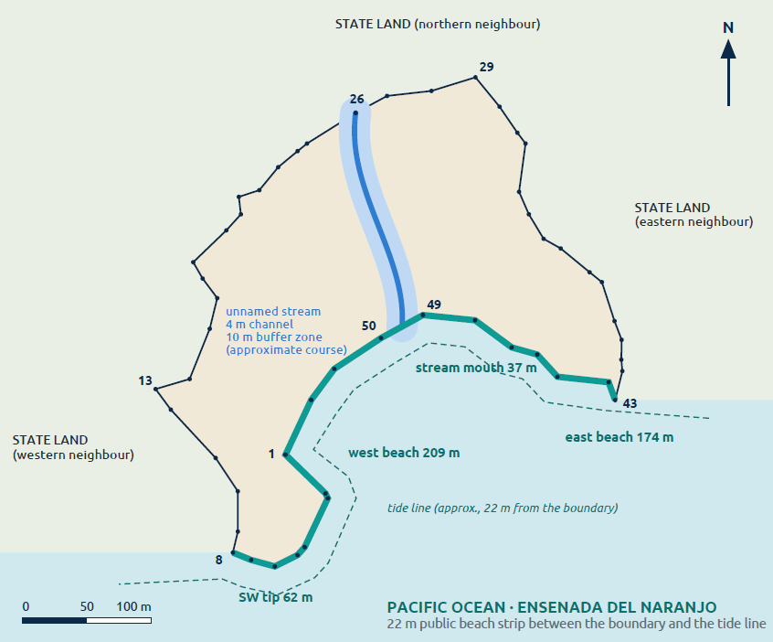
| East beach | 43 – 49 | 174.2 m |
| Mouth of the stream | 49 – 50 | 37.1 m |
| West beach | 50 – 4 | 209.2 m |
| South-west tip (rocky) | 4 – 8 | 62.2 m |
| Total coastal frontage | 43 – 8 | 482.62 m |
Lengths measured along the boundary with the public beach strip, according to the plan’s field data. Between the boundary and the tide line lies the 22 m public beach strip, which sits entirely in front of the property. General orientation of the frontage: south-southeast.
The beach
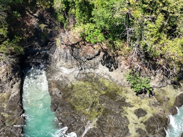
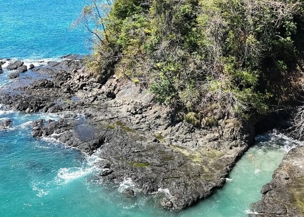
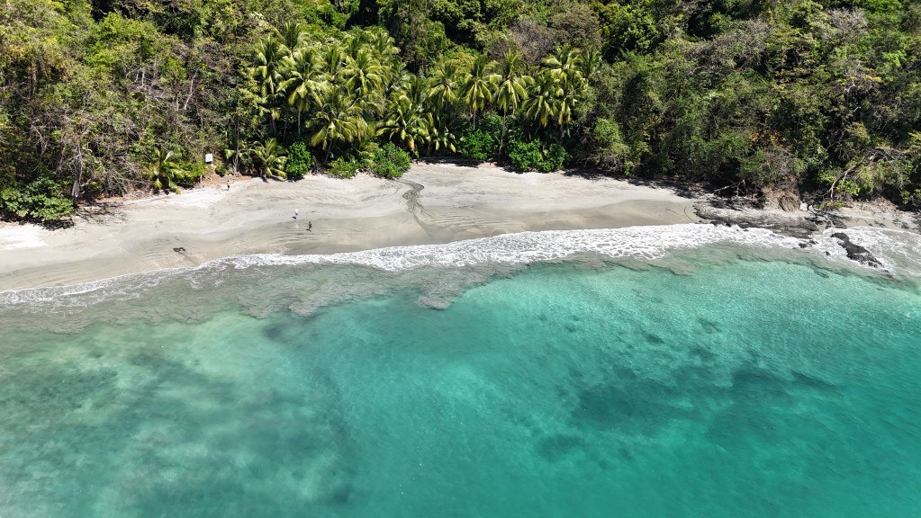
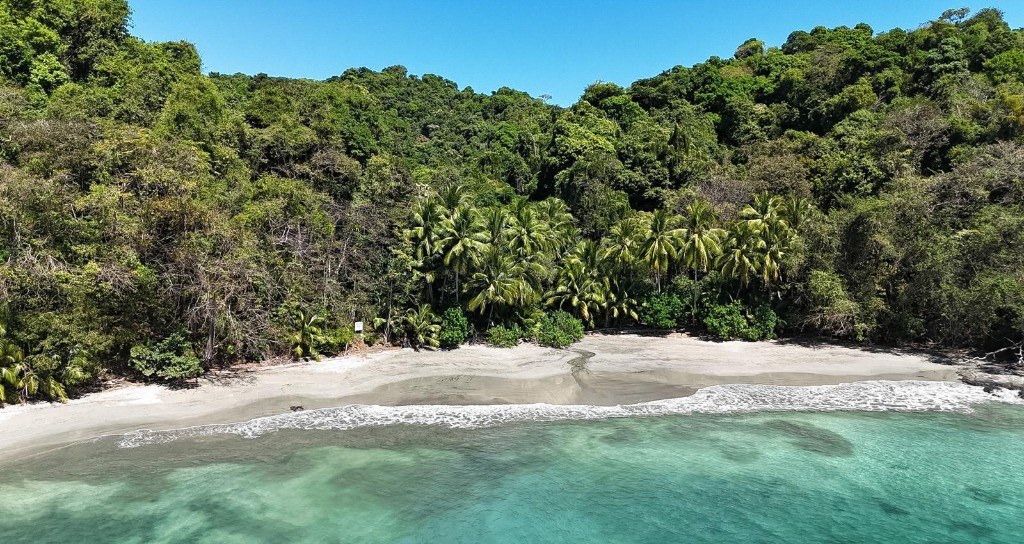
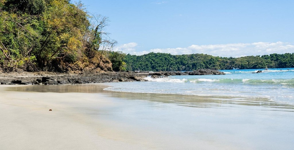
Fine, light-coloured sand, wide at low tide and gently sloping; a mature coconut palm grove behind the beach. Transparent turquoise water over a visible sand-and-rock bottom, ideal for swimming and snorkelling. Volcanic-rock formations at both ends form natural pools and channels. Moderate surf inside the bay.
Access
The property is reached by sea, landing directly on the beach inside a sheltered deep-water bay that serves as a natural anchorage for boats and larger vessels. From Panama City in ≈ 2 h: charter or empty-leg flight (≈ 45 min – 1 h) to the private Lago Bay airstrip (MPLY) at Hicaco (Santa Catalina); five minutes from the airstrip you board at Hicaco and reach the property in 45 min by boat (≈ 20 miles), with whales, dolphins, turtles and tuna along the way. Next to the airstrip there are rental villas the owners already use on their visits. Other departure points: Puerto Mutis (Gulf of Montijo), Playa Reina and Playa Malena. The plan shows no vehicle access or land right-of-way; the nearest map reference is Cocobolo (≈ 1.4 km to the north-west).
Description
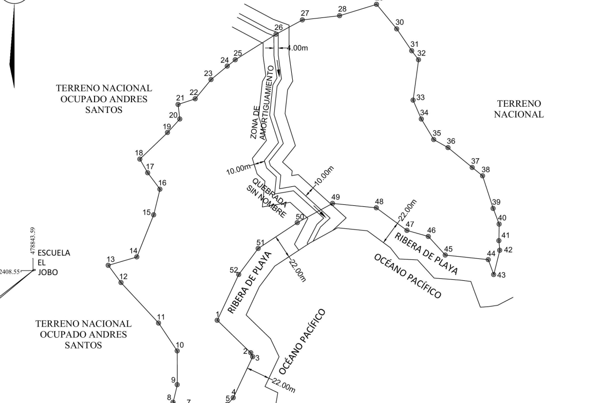
The land is crossed by a year-round freshwater stream (shown on the plan as «Quebrada sin nombre», unnamed stream) that enters through the northern boundary near point 26, runs down the centre of the land southwards and flows out onto the beach between points 49 and 50. In the aerial photographs of January 2026 —the height of the dry season— its channel carries water over the sand all the way to the shore.
Plan data
| Channel width | ≈ 4.00 m |
| Buffer zone | 10.00 m on each bank (≈ 24 m total width including the channel) |
| Course inside the lot | ≈ 170 m in a straight line (longer following the winding channel) |
| Entry / exit | Northern boundary (point 26) / mouth on the beach (points 49–50) |
Value for the property
A natural anchorage
The Ensenada del Naranjo is a sheltered deep-water bay with a natural anchorage in front of the beach: boats and larger vessels can anchor at the foot of the property and operate from it without any port infrastructure. It is the ideal starting point for an offshore-fishing, diving and excursion base on the Pacific coast of Veraguas.
Offshore and inshore fishing
Diving, snorkelling and boating
Coiba National Park (UNESCO World Heritage Site) is one of the great diving destinations of the Pacific: sharks, mantas, turtles and huge schools of fish. On the property’s own beach, the volcanic-rock pools and channels invite snorkelling at low tide; the bay, kayaking and paddle-boarding.
Distances by sea
| Hicaco (Santa Catalina) | ≈ 20 miles · 45 min by boat, with whales, dolphins, turtles and tuna along the way |
| Lago Bay airstrip (MPLY) | 5 min from Hicaco · charter and empty-leg flights from Panama City in ≈ 45 min – 1 h· rental villas |
| Isla Coiba | ≈ 40 km to the west · ≈ 1 hour by fast boat |
| Puerto Mutis | 30–40 km · road access from Santiago de Veraguas |
| Hannibal Bank | South-west of Coiba · full-day trip |
A sheltered bay with ≈ 483 m of beach, its own fresh water, tropical forest and Coiba National Park on the horizon, about 2 hours from Panama City thanks to charter and empty-leg flights to Hicaco (Santa Catalina): few properties on Panama’s Pacific coast combine so many vocations in one place. The logistics already work today — villas next to the airstrip, boat from Hicaco, Starlink and solar power on the island— and every alternative starts from the same base: untouched natural beauty and a natural anchorage at the foot of the beach.
A · Offshore-fishing lodge and nautical base
A fishing camp or lodge with its own boats anchored in the bay and trips to Coiba, Hannibal Bank, the Gulf of Montijo and the Gulf of ChiriquÃ. High-spending international clientele, a long season and a product that is scarce in the region.
B · Beach glamping and eco-resort
Safari tents, domes or raised cabins in the palm grove and on the hillsides overlooking the bay: light, low-impact structures that are quick to deploy and compatible with the current status of the land, evolving later into a boutique eco-lodge.
C ·Surf, diving and adventure
A base for surf trips to Santa Catalina and the Mariato coast (the most established surf destination on Panama’s Pacific), diving and snorkelling in Coiba, kayaking and paddle-boarding in the bay, hiking along the stream and through the forest, whale watching.
D · Private retreat in nature
A family estate or corporate hideaway: main house facing the beach, guest cabins in the forest, fresh water from the stream, solar power and a private boat; high-end rental when not in use.
Phased development
Phase 1 — Glamping and nautical base: light structures in the palm grove, anchorage in the bay, water from the stream, solar power and Starlink (already in use); tourist trips can be organised right away with the airstrip villas and the boat from Hicaco.
Phase 2 — Eco-lodge: cabins in the palm grove and viewpoints on the hillsides once titling is complete.
Phase 3 — Full product: fishing and diving lodge with its own fleet and a Coiba – Santa Catalina experience programme.
≈ 483 m of beach
Sand, palm grove and two rocky points with natural pools.
Own fresh water
Year-round stream flowing at the height of the dry season.
Natural anchorage
Sheltered bay: boats and larger vessels at the foot of the beach.
2 h from the capital
Charter or empty-leg flight to Lago Bay + 45 min by boat from Hicaco; Coiba 1 hour away.
Current situation
Legal status and considerations
Available documentation
| Side | Bearing | Distance (m) | North (Y) | East (X) |
|---|---|---|---|---|
| 1–2 | S 45°53’41” E | 43.130 | 828,612.148 | 474,282.446 |
| 2–3 | S 25°33’56” E | 4.103 | 828,608.447 | 474,284.217 |
| 3–4 | S 25°20’38” W | 41.867 | 828,570.609 | 474,266.296 |
| 4–5 | S 42°02’48” W | 8.288 | 828,564.455 | 474,260.745 |
| 5–6 | S 63°29’49” W | 19.661 | 828,555.681 | 474,243.150 |
| 6–7 | N 74°41’52” W | 18.969 | 828,560.687 | 474,224.854 |
| 7–8 | N 68°08’21” W | 15.288 | 828,566.380 | 474,210.666 |
| 8–9 | N 13°29’30” E | 16.713 | 828,582.631 | 474,214.565 |
| 9–10 | N 00°01’52” W | 31.207 | 828,613.838 | 474,214.548 |
| 10–11 | N 33°45’21” W | 31.006 | 828,639.617 | 474,197.320 |
| 11–12 | N 42°51’47” W | 51.002 | 828,677.000 | 474,162.626 |
| 12–13 | N 36°28’15” W | 19.813 | 828,692.933 | 474,150.848 |
| 13–14 | N 73°33’37” E | 27.480 | 828,700.710 | 474,177.205 |
| 14–15 | N 21°49’12” E | 41.865 | 828,739.575 | 474,192.765 |
| 15–16 | N 13°45’18” E | 24.439 | 828,763.313 | 474,198.576 |
| 16–17 | N 36°42’37” W | 18.877 | 828,778.446 | 474,187.292 |
| 17–18 | N 29°58’52” W | 14.636 | 828,791.124 | 474,179.979 |
| 18–19 | N 46°08’05” E | 35.526 | 828,815.742 | 474,205.592 |
| 19–20 | N 42°17’33” E | 16.786 | 828,828.159 | 474,216.888 |
| 20–21 | N 06°45’35” W | 13.601 | 828,841.666 | 474,215.287 |
| 21–22 | N 71°51’53” E | 16.723 | 828,846.871 | 474,231.180 |
| 22–23 | N 39°25’26” E | 22.989 | 828,864.629 | 474,245.779 |
| 23–24 | N 50°22’16” E | 19.513 | 828,877.075 | 474,260.808 |
| 24–25 | N 51°12’52” E | 9.354 | 828,882.934 | 474,268.099 |
| 25–26 | N 57°53’51” E | 44.481 | 828,906.573 | 474,305.779 |
| 26–27 | N 61°29’45” E | 27.688 | 828,919.786 | 474,305.779 |
| 27–28 | N 83°34’38” E | 34.615 | 828,923.658 | 474,364.508 |
| 28–29 | N 72°48’55” E | 35.687 | 828,934.202 | 474,398.602 |
| 29–30 | S 39°22’22” E | 29.370 | 828,911.499 | 474,417.233 |
| 30–31 | S 34°23’27” E | 24.496 | 828,891.284 | 474,431.070 |
| 31–32 | S 37°11’36” E | 10.456 | 828,882.955 | 474,437.390 |
| 32–33 | S 07°39’06” W | 37.716 | 828,845.575 | 474,432.368 |
| 33–34 | S 23°33’11” E | 18.967 | 828,828.188 | 474,439.948 |
| 34–35 | S 31°05’40” E | 22.169 | 828,809.204 | 474,451.397 |
| 35–36 | S 60°36’07” E | 15.163 | 828,801.761 | 474,464.607 |
| 36–37 | S 50°35’43” E | 28.985 | 828,783.362 | 474,487.003 |
| 37–38 | S 51°09’08” E | 12.235 | 828,775.687 | 474,496.532 |
| 38–39 | S 17°58’12” E | 31.689 | 828,745.544 | 474,506.309 |
| 39–40 | S 20°49’04” E | 15.520 | 828,731.037 | 474,511.825 |
| 40–41 | S 00°56’43” W | 15.341 | 828,715.698 | 474,511.571 |
| 41–42 | S 05°15’40” E | 8.901 | 828,706.834 | 474,512.388 |
| 42–43 | S 14°00’03” W | 23.094 | 828,684.426 | 474,506.800 |
| 43–44 | N 20°08’11” W | 14.705 | 828,698.232 | 474,501.738 |
| 44–45 | N 83°53’17” W | 39.846 | 828,702.475 | 474,462.119 |
| 45–46 | N 42°24’12” W | 23.233 | 828,719.631 | 474,446.452 |
| 46–47 | N 74°16’38” W | 20.541 | 828,725.197 | 474,426.679 |
| 47–48 | N 53°33’04” W | 35.309 | 828,746.174 | 474,398.277 |
| 48–49 | N 84°16’37” W | 40.539 | 828,750.217 | 474,357.940 |
| 49–50 | S 61°15’32” W | 37.060 | 828,732.396 | 474,325.446 |
| 50–51 | S 56°35’21” W | 43.323 | 828,708.541 | 474,289.282 |
| 51–52 | S 36°42’36” W | 30.004 | 828,684.487 | 474,271.346 |
| 52–1 | S 25°09’01” W | 46.754 | 828,642.166 | 474,251.476 |
Area: 5 ha + 8,928.21 m² · Perimeter: 1,330.72 m · Point 1: N 828,642.166 / E 474,251.476
Bahía de Naranjo · Isla Cebaco
5.89 ha on the sea · 483 m of beach · year-round freshwater stream · facing Coiba · ≈ 2 h from Panama City (air + boat)
CONTACT
Owner / representative: Sociedad Mata Bruja, S.A.
Contact details: to be completed by the owner before sending.
DISCLAIMER
The information in this document is based on the topographic survey plan of October 2026, on photographs of the land taken in 2026 and on public sources about Isla Cebaco and its region. The measurements and lengths come from the plan’s field data and the descriptions of the land from the photographic inspection; they must be verified by the buyer and confirmed in the titling process before ANATI. The land is undergoing titling (parcel for tourism use under purchase application to the State); the 22 m public beach strip is public domain. The development alternatives are indicative and subject to the relevant permits. Flight, transfer and boat times are indicative, according to public information from the operators. This document does not constitute a binding offer or legal advice.
Compare listings
Compare